
 Trekking
Annapurna Circuit Trek
Follow the Marsyangdi valley to Manang, take time to acclimatize and cross Thorong La at about 5,416 m before descending into the Kali Gandaki valley.
DestinationNepal
Duration15 days
DifficultyChallenging
ActivityTrekking
AccommodationHotels at city stops and teahouses along the trekking route
MealsThe meal plan and any included drinks are confirmed in your quotation
Highest visited point5,416 m
Highest overnight4,450 m
Preferred seasonsApril–May and September–November, subject to pass and road conditions
The journey at a glance
Annapurna Circuit Trek overview
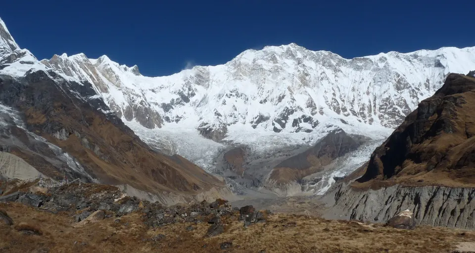
The Annapurna Circuit is a journey through changing landscapes: lower river valleys, pine forest, the drier upper valley around Manang and the high crossing of Thorong La. This 15-day outline begins in Kathmandu, approaches the walking route through Besisahar and Dharapani, and finishes by traveling through Pokhara back to Kathmandu.
The route keeps the focus on the main circuit. It includes a second night in Manang and separates the approach to Thorong Phedi into overnight stops at Yak Kharka and Ledar. These stages make the upper-valley progression easier to understand, but they do not remove the need to assess symptoms or add time. Thorong Phedi is the planned highest sleeping location at about 4,450 m; the pass is a much higher daytime crossing at about 5,416 m.
Pass day is the hardest part of the outline. An early departure, sustained ascent, cold or wind and a long descent toward Muktinath all contribute to the effort. The crossing depends on the trail being suitable and every trekker being well enough to proceed. There is no guaranteed pass crossing simply because it appears in a booked schedule.
Tilicho Lake is a separate extension. This 15-day route does not include the lake or a crossing of Mesokanto La. Adding Tilicho changes the number of days, acclimatization plan, exposed-trail assessment and quotation. Our Annapurna Circuit and Tilicho guide explains the difference.
Road access has changed parts of the lower circuit. The final proposal should identify where you walk, where you use vehicles and which alternatives are practical for your dates. Send your preferences if you would like more village walking, shorter stages or extra contingency days.
Moments to look forward to
- Follow the Marsyangdi valley from Dharapani toward Chame and Pisang
- Explore the landscape around Manang with a second night at the same altitude
- Approach Thorong Phedi through separate Yak Kharka and Ledar stops
- Cross Thorong La when conditions and acclimatization allow
- Descend to Muktinath and walk through Kagbeni toward Jomsom
Your day-by-day journey
Download PDFDAY 01Arrive and prepare in Kathmandu
Settle into Kathmandu and review the route, equipment and transport choices. Discuss your recent walking experience and the demanding pass day before starting. The proposal should clearly identify accommodation, meals, permits, staffing and the arrangements for changes caused by weather or health.
Kathmandu → KathmanduTime: No scheduled trekking Highest visited: 1,400 m Sleep at: 1,400 m Hotel As agreed in your quotation
DAY 02Travel to Besisahar
Travel toward the Marsyangdi valley and Besisahar. Keeping this as a separate travel day avoids making a long road journey continue immediately to a high mountain overnight. Traffic, highway works and weather can change the arrival time; any onward vehicle arrangement should remain flexible.
Kathmandu → BesisaharTime: No scheduled trekking; road travel about 6–8 hours Sleep at: 760 m Hotel or local guesthouse As agreed in your quotation
DAY 03Continue by road to Dharapani
Continue along the mountain road to Dharapani, using the vehicle arrangement in the quotation. The rougher road makes this a slow travel day despite the relatively short map distance. Confirm the following walking route and rest before the sustained trek toward Chame.
Besisahar → DharapaniTime: No scheduled trekking; road travel about 4–6 hours Highest visited: 1,860 m Sleep at: 1,860 m Teahouse As agreed in your quotation
DAY 04Walk from Dharapani to Chame
Follow the upper Marsyangdi valley through settlements and forest toward Chame. The route includes climbs and sections where local trail choices help avoid the motor road when practical. This is a substantial first walking day, so leave enough time for a steady pace and ordinary rest stops.
Dharapani → ChameTime: About 6–7 hours Highest visited: 2,670 m Sleep at: 2,670 m Teahouse As agreed in your quotation
DAY 05Continue to Lower Pisang
Walk farther into the valley as the landscape becomes more open around Pisang. The sleeping altitude rises above 3,000 m; avoid treating the familiar trail or good weather as a reason to hurry. The planned overnight is Lower Pisang, with any local exploration dependent on arrival time and wellbeing.
Chame → Lower PisangTime: About 5–6 hours Highest visited: 3,200 m Sleep at: 3,200 m Teahouse As agreed in your quotation
DAY 06Follow the lower valley route to Manang
Continue by the lower-valley approach through the Braga area toward Manang. This outline uses that route to keep the day less demanding than the high Ghyaru–Ngawal alternative. Travelers who want the upper villages should add time and agree a revised overnight plan rather than assume a side excursion fits easily.
Lower Pisang → ManangTime: About 5–6 hours Highest visited: 3,540 m Sleep at: 3,540 m Teahouse As agreed in your quotation
DAY 07Spend a second night in Manang
Remain in Manang and consider a gentle local walk toward a suitable viewpoint above the village, returning to the same sleeping altitude. The aim is time at altitude, not a race to a high viewpoint. Rest instead if needed and review readiness for the next stage.
Manang → ManangTime: Optional local walking, about 2–4 hours Highest visited: 3,800 m Sleep at: 3,540 m Teahouse As agreed in your quotation
DAY 08Climb gradually toward Yak Kharka
Leave the main village area and follow the upper trail toward Yak Kharka. The thinner air often makes a modest-looking distance feel slower. Take the roughly 510 m sleeping-height gain seriously and keep the afternoon quiet. Any altitude symptoms should be discussed before considering further ascent.
Manang → Yak KharkaTime: About 4–5 hours Highest visited: 4,050 m Sleep at: 4,050 m Teahouse As agreed in your quotation
DAY 09Make the short stage to Ledar
Continue a short distance to Ledar and remain at a similar altitude for much of the day. This extra upper-valley stop reduces the distance and sleeping-height gain of the following approach. A short optional walk should stay modest and should not replace rest if you are tired or unwell.
Yak Kharka → LedarTime: About 2–3 hours Highest visited: 4,200 m Sleep at: 4,200 m Teahouse As agreed in your quotation
DAY 10Approach Thorong Phedi
Follow the approach to Thorong Phedi, taking care on exposed or loose sections where current trail conditions govern the walking line. Stay at Phedi rather than moving the overnight to High Camp. Review the weather, trail, group condition and turnaround options before deciding whether the pass attempt is appropriate.
Ledar → Thorong PhediTime: About 3–4 hours Highest visited: 4,450 m Sleep at: 4,450 m Teahouse As agreed in your quotation
DAY 11Cross Thorong La and descend to Muktinath
When the trail and individual condition allow, start early for the sustained ascent to Thorong La, approximately 5,416 m. The crossing is followed by a long descent toward Muktinath. Cold, wind, snow and fatigue can all change the day; keep a conservative turnaround decision and do not treat the pass as compulsory.
Thorong Phedi → MuktinathTime: About 8–12 hours Highest visited: 5,416 m Sleep at: 3,800 m Teahouse As agreed in your quotation
DAY 12Walk down toward Kagbeni
Descend through the dry landscape toward Kagbeni, with time for the villages and a slower pace after the pass. The route stays within the ordinary circuit approach; travel into the Upper Mustang restricted area is a separate journey requiring different arrangements. Respect local religious sites and ask before photographing people.
Muktinath → KagbeniTime: About 3–4 hours Highest visited: 3,800 m Sleep at: 2,810 m Teahouse As agreed in your quotation
DAY 13Continue through the valley to Jomsom
Follow the Kali Gandaki valley toward Jomsom. Wind and dust can make the open valley less comfortable later in the day, so walking time and departure are adjusted locally. Use the remaining time to rest and confirm the onward road or flight arrangement.
Kagbeni → JomsomTime: About 3–4 hours Highest visited: 2,810 m Sleep at: 2,720 m Teahouse As agreed in your quotation
DAY 14Travel from Jomsom to Pokhara
Travel to Pokhara by the arrangement agreed in the quotation. Road travel can take most of the day on rough and winding sections. A flight is a separate option subject to availability, weather and operations; a delayed or canceled flight may require a different plan.
Jomsom → PokharaTime: No scheduled trekking; road travel about 8–11 hours Highest visited: 2,720 m Sleep at: 822 m Hotel As agreed in your quotation
DAY 15Return to Kathmandu
Complete the return to Kathmandu by the agreed transport. Allow a separate buffer before an international flight rather than planning a tight connection after this travel day. Additional time is especially useful if the pass or the Jomsom return has been disrupted.
Pokhara → KathmanduTime: No scheduled trekking; road travel about 7–10 hours Sleep at: 1,400 m Hotel As agreed in your quotation
What your quotation covers
Request a written quotation for your dates and group. The itinerary describes the route; your quotation identifies the services included and any costs paid separately.
Confirm the arrangements
- Guide and porter arrangements, including luggage limits
- Transport sectors, airport connections and transfers
- Accommodation, room sharing and meals
- Route permits and entry tickets
Check separate expenses
- International travel, visa and travel insurance
- Personal equipment, drinks, charging and showers
- Optional activities and discretionary tips
- Additional nights or transport if plans change
Choose how you travel
Have dates in mind?
Published group dates are not currently available. Tell us when you’d like to travel.
A journey around your plans
Share your dates, interests and preferred pace for a personal itinerary.
Customize TripWhat to bring
Prepare for warm lower-valley days and cold, windy conditions around Thorong La. Bring broken-in footwear, layered insulation, a waterproof and windproof outer layer, warm gloves and headwear, sun protection, a headlamp and spare power for essential devices.
A sleeping bag suitable for the agreed season, reusable water containers, personal medication and a small first-aid kit belong on the final equipment checklist. Confirm whether porters, a duffel or other equipment are part of your quotation; do not assume an unlimited baggage allowance.
Ask about the current need for traction equipment before departure. Carry only equipment you know how to use, and treat snow or ice as a route decision as well as a packing issue. Keep items needed during the walking day accessible rather than in porter luggage.
Before you set out
Acclimatization and the pass
The sleeping elevations are approximately Manang 3,540 m, Yak Kharka 4,050 m, Ledar 4,200 m and Thorong Phedi 4,450 m. Heights vary between maps and lodge locations. The Manang rest day and shorter upper stages support a measured approach, but symptoms may require another night or a descent. Follow current CDC altitude guidance; fitness is not a guarantee against altitude illness.
Permits and route scope
The main circuit falls within ACAP, and current guide and TIMS requirements should be checked through NTNC and Nepal Tourism Board. Tilicho, the Upper Mustang restricted area and technical side routes are not included in this itinerary. Any extension needs its own written route and service agreement.
Transport and spare time
Jomsom–Pokhara road travel is long and rough in places; a flight, if selected, depends on weather and operations. The return to Kathmandu is another travel day. Keep additional time before international travel and agree in advance how extra nights, alternative transport or a delayed pass attempt would be handled. All walking times are estimates, not daily deadlines.
Your questions, answered
Does the 15-day Annapurna Circuit include Tilicho Lake?
No. This route follows the main circuit over Thorong La. Tilicho requires a separate side route, extra days and a revised acclimatization and trail plan. Ask for it explicitly when requesting a quotation.
What are the highest walking and sleeping elevations?
Thorong La is the highest point at approximately 5,416 m. The planned highest overnight is Thorong Phedi at approximately 4,450 m. Map and lodge elevations vary, so treat these as planning figures.
Can I avoid the high pass?
A Manang valley journey can be planned without crossing Thorong La, but it is a different itinerary with different return transport. If conditions prevent a crossing during the trip, the route must change rather than force the pass.
Why are there separate nights at Yak Kharka and Ledar?
The shorter stages reduce the daily distance and distribute the approach to Thorong Phedi. They support a measured schedule but do not guarantee acclimatization; extra rest or descent may still be necessary.
Are the road transfers and flights included?
The quotation states the transport for each travel day. Road and air options are not interchangeable promises, and flights depend on operating conditions. Confirm alternatives and possible additional costs in advance.
Travel information & sources · checked 25 Oct 2026
- Nepal Hiking Team: Annapurna Circuit route
- Nepal Hiking Team: Tilicho extension
- National Trust for Nature Conservation: permit support
- Nepal Tourism Board: TIMS and guided routes
- CDC: Travel to High Altitudes
Times and elevations are approximate. Check current rules and conditions for your dates.
Plan this journey with confidence
Keep exploring
Another trail, another story
Trekking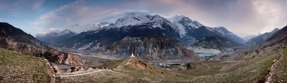 Day hikes
15 days in NepalRequest a quote